Advantech Design are pleased to announce the release of a new TRANSnet Public Transport Priority control system which has been designed to actively monitor public transport journey and travel times throughout the city area, and provide extremely advanced Public Transport Priority and Performance Reporting functions.
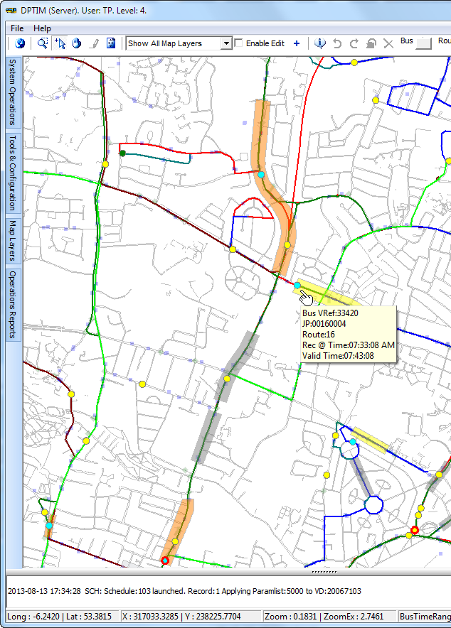
The system is a multi-user map-based application that processes live bus location information in real-time. The data feed front-end consists of a versatile Database Loader which currently receives and processes vehicle location data. All data is stored in a Relational Geospatial Database (Microsoft SQL Server 2008 R2). This includes route data, virtual detector data, bus locations data, and all log reports.
Virtual Detector zones are created on the map surface by a privileged operator. All drawing, editing, configuration, reporting tools etc are incorporated into the package. Because detectors are created graphically, and can be placed anywhere, it is extremely versatile and requires no on-road hardware changes, controller or personality modifications etc. Detectors can be placed mid-block, at stop lines etc, with total flexibility. There are essentially no limits on the number of detectors, junctions, or Priority Activities that can be implemented by the system.
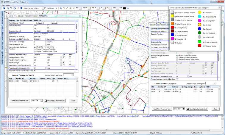
A comprehensive Calendar Scheduler allows different trigger point parameters to be applied to any virtual detector by time-of-day, day of week, etc. This allows for different priority operation for Peak Periods, Weekends, Public Holidays, etc.
Once priority is applied at an intersection, the system continually checks the trigger conditions, and can also escalate priority if required. Escalation is via a progressive linked-list so that there is essentially no upper limit to the number of different types of further priority that can be applied.
The system can be programmed to control more than one intersection once a trigger condition is detected. For example, if a bus is detected behind schedule, corresponding cycle-length or phase-times might be increased at intersections further downstream to provide additional priority to assist to proactively restore the schedule, rather than waiting for the vehicle to be detected at other specific locations before commencing further priority improvements.
On screen hints allow the easy identification of individual vehicles, virtual detectors, traffic signals, journey patterns, bus garages etc.
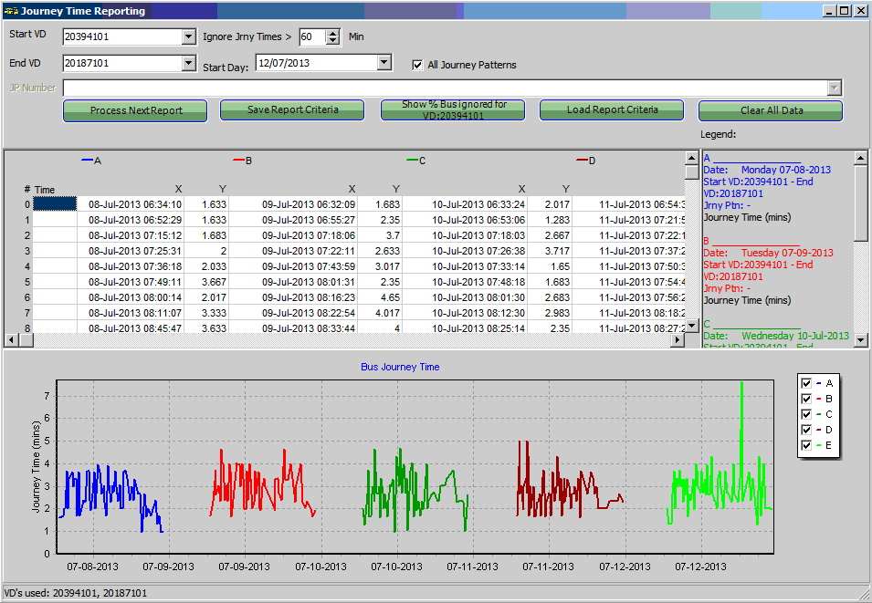
Comprehensive performance reporting on vehicle journey times (absolute, average, exponentially weighted etc) is also available and presented to the user via graphical (chart) and tabulated data displays. Once any report criteria has been defined, it can be optionally saved and recalled at any time for undertaking comparative performance purposes.
All events controlled by the system, as well as user actions are logged, and extensive reports with selection criteria filters are available to review this data.